Showing posts with label Clark. Show all posts

Monday, November 3, 2014

Rogers Park Roofscape


This is another view from the Rogers Park Metra platform looking to the northeast.  I posted another view to the southeast a few months back, which can be viewed here.

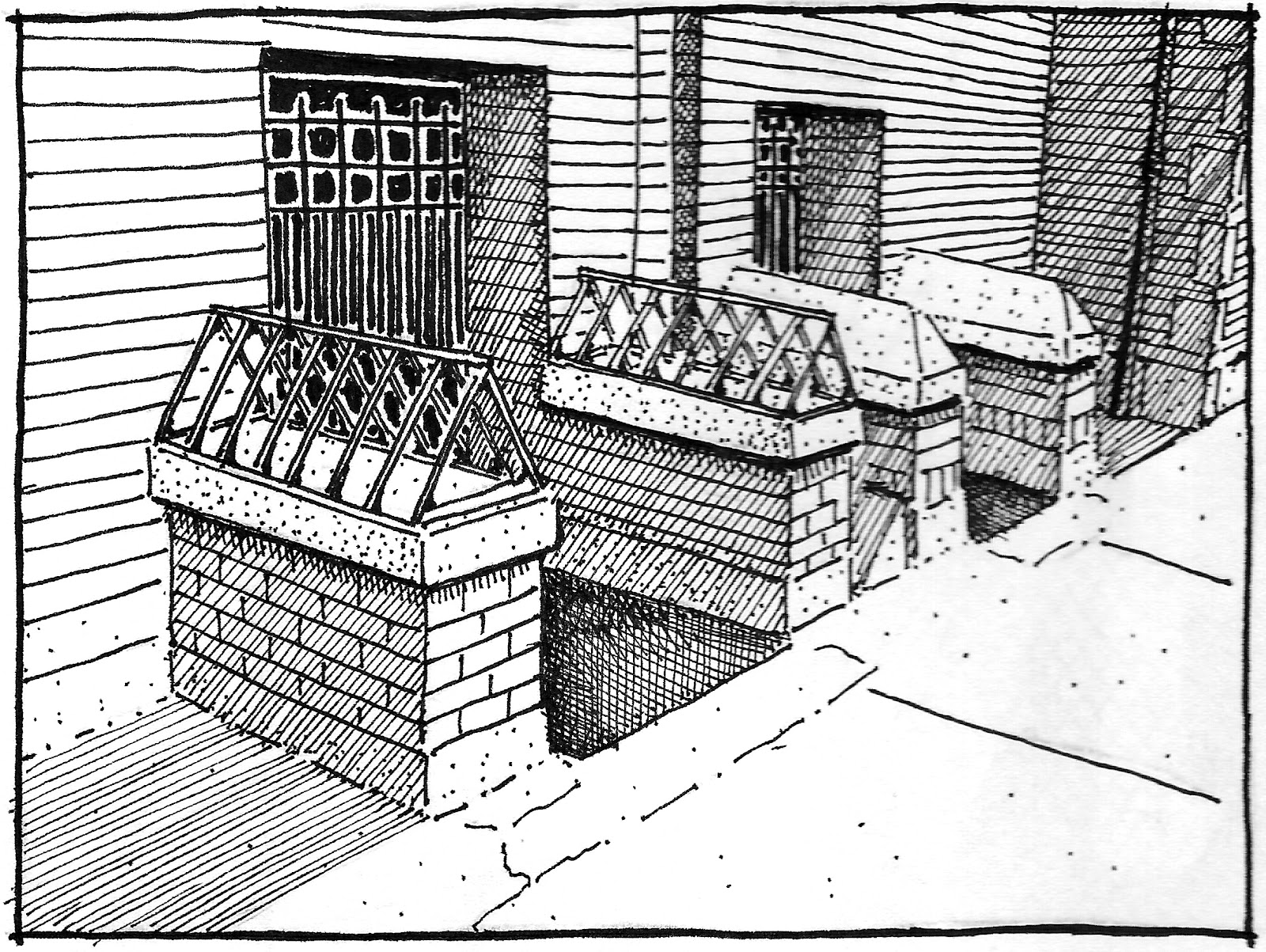
I'm becoming more interested in rooftops and alleys, maybe because they reveal design relationships which are more complex than what's viewed from the street, and allowing some investigation into the nuts and bolts that create a streetscape.   Views across the rooftops are like x-rays, revealing service spaces, private retreats, and structural detail all interlocking with each other.

For some reason I did a colorized version.  Which really doesn't add much information, but looks kinda cool.

Thursday, January 2, 2014

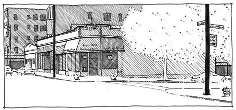
Storefront at 6962 N. Clark, 2006

Many blogs post their most popular entries around the new year. Great idea! But instead, here's one of the least popular entries, originally posted on 9/5/06. According to the counter, this was viewed 11 times in the past 7 years! Still, I do like the image.
___________________________________________________________________________

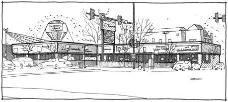
With the days getting shorter my evening walks with Felix have gotten much darker. I find myself drawn to the strangely organized and uncomfortably configured storefronts on Clark. In this case I'm not sure exactly what they're selling. Pretty much everything? The confusion and disarray makes it a pretty good subject for a drawing.

So I've been taking photographs of these amazing storefronts. I'm not sure where it's leading, but it's a good opportunity to play around with color.  This is a combination of Prismacolor markers and color pencils.

___________________________________________
Note:  This storefront has been completely replaced with a modern aluminum system.  I miss it.

Thursday, June 21, 2012

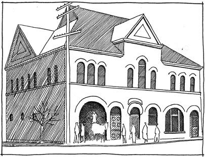
Clark and Estes, northwest corner 1900 and 2008

 
Combined Police Headquarters and Fire Department, c. 1900
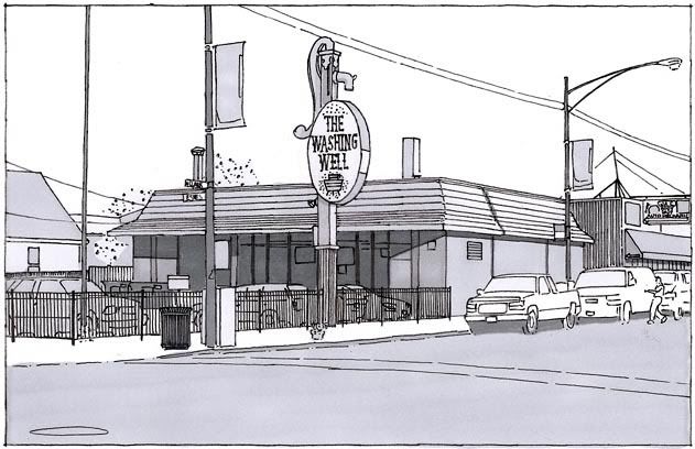
In sad recognition of the recent closing of The Washing Well I'm reposting this from December of 2008.

The drawing to the right is adapted from a collection of historic Rogers Park photos published by the Rogers Park/West Ridge Historical Society.  I've done a number of these "then and now" pairings, but this is one of my favorites.

The police and fire station at Clark and Estes also operated as the Rogers Park Town Hall prior to annexation to Chicago in 1893.

The Washing Well Laundromat, 2008


Monday, April 16, 2012

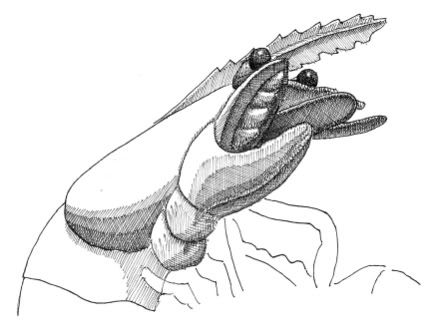
Huge Crayfish on Clark and Wallen, 2006

I'm sorry to say that the giant crayfish is gone.  These images were originally posted in 2006.  The life of a taqueria on Clark is either wildly successful or very short.  Mostly very short.  This repost is my memorial...

Wouldn't it be interesting if all restaurants were required to incorporate their most popular dish into their signage? That would be useful for all of the Rogers Park tourists.  There are Rogers Park tourists, right?


This huge crayfish started out a cheerful red, but the sun weathered it to a light orange.

Friday, April 6, 2012

Clark, Greenleaf, Ravenswood and Estes- Part 2

Anybody who studies American cities knows the value of the Sanborn Fire Insurance Maps.  These were created by the Sanborn Map Company to help insurance adjusters evaluate risk.  Copies of all maps were deposited with the Library of Congress, and were later microfilmed for distribution to local libraries.  An agreement with ProQuest put scanned versions of the microfilmed maps (660,000 of them) online for subscription access.

The Chicago Public Library makes these maps available, so at least access is broadening.  Many of the denser areas in Rogers Park were included in several editions.  When these are compiled it provide a portrait of development through time.  These maps are crammed with information, and the problem is often choosing which type of information is most useful to highlight. 

In this case the maps are focused on heights, with the light grey, dark grey and black showing 1, 2, and 3 stories respectively. It's also possible to focus on type of construction (frame, masonry veneer, steel reinforced concrete) or type of use.  Cross reference this with extensive title research, census records, and phone directories and you can build up a fairly precise history of a block.  In theory that block would reflect the larger trends of the neighborhood.  But I still have to manage a job, a family and a life, so the next step may just be a somewhat closer look at each of these dates.

Bird's Eye Aerial from Bing. Probably 2008.


Wednesday, March 28, 2012

Clark, Greenleaf, Ravenswood and Estes, Part 1

The biggest property disaster that I know of in Rogers Park was a fire that burned down nearly the entire block bounded by Clark, Greenleaf, Ravenswood and Estes.   It was documented in the Chicago Tribune with a map of the burned area and a line drawing showing the destruction.  I recreated the map in order to add labels, but I can't improve on the drawing, which somehow came through microfilming (and then scanning) with a good amount of its detail intact.  Welcome to Rogers Park, 1894.

Looking Northeast through the burned area. From the August 9th, 1894 Chicago Tribune.

The article mentions that 14 buildings were lost, including stores, factories and dwellings.   It even provided a table itemizing the losses.  I've done my best go through the description and map out where I believe everything was located, but I'm only about 70% sure of my accuracy.

But so what? There was a big fire in Rogers Park over a hundred years ago and a bunch of people lost their homes and businesses.  How does that impact the neighborhood today? To investigate this maybe we need to go back another Chicago fire that's become a defining element in the conception of the modern Chicago.

After the fire of 1871 Chicago didn't rise from the ashes with dozens of skyscrapers stretching upward. The first steel frame skyscraper wasn't even constructed until 1884.  Instead Chicago rebuilt itself much as it had been, except that the city government scrambled to adopt new building codes and regulations to minimize the chances of another catastrophic fire.

It took years to adopt the regulations for new fire-resistant and fireproof construction and property owners and builders screamed the entire way.  (I definitely recommend Margaret Garb's "City of American Dreams" which describes this era vividly.)  One outcome of this assertion of governmental responsibility was an overall strengthening of the administrative policies of Chicago related to building.  This came to influence the look of the city far more than any fire.  Height limits, minimum construction standards, setbacks,  exiting requirements, etc. all became a part of the modern Chicago.

Rogers Park was annexed to Chicago a year before the fire, in 1893.  This meant that any new development on the damaged block had to conform to the new construction standards.  So this disaster provides me with something useful-- a clean slate.  Periodically I'm going to be taking a closer look at how this block developed post-fire, and what it might reveal about Rogers Park in particular and about Chicago in general.


Thursday, February 23, 2012

Building Paranoia in Rogers Park

A few years ago I found a great collection of essays in a book titled, Architecture of Fear (1997), which contained the article “Building Paranoia,” by Steven Flusty.  It was adapted from a paper published for the Los Angeles Forum for Architecture in 1994 and develops a vocabulary for describing the kinds of spaces he saw being created throughout the L.A. region.  I remember reading this chapter, shuddering, and being thankful that I don’t live in L.A. Here's a quick summary:


Stealthy Space
Space that is obscured and cannot be found.

Slippery Space
Space that cannot be reached, due to contorted, protracted, or missing paths of approach

Crusty Space

Space that cannot be accessed, due to obstructions such as walls, gates, checkpoints, etc.

Prickly Space
Space that cannot be comfortably occupied.

Jittery Space
Space that cannot be utilized unobserved.

South side of Estes West of Sheridan
But soon I started to spot the same things in my own neighborhood.  Perfectly nice corners were being transformed into miniature prisons.  Storefronts were installed that could withstand medieval sieges.  Homes and apartments destroyed their beauty in the name of security. 

Chicago’s grid tends to discourage the creation of Stealthy and Slippery Space.  These seem to be more common in suburban areas, or large redeveloped areas.  But I’ll bet anyone can think of a few Crusty, Prickly, and Jittery Spaces in their own neighborhood.  Following are a few examples that I found uncomfortably close to home.


North side of Estes, East of Sheridan
What you see here are steel and concrete modifications to eliminate a potential gathering or resting spot.  One set is welded iron, and the other is cast concrete.  In another era maybe they would have set broken glass on the surfaces. I wonder what was going on out here that had to be eliminated.  Noisy kids?  Vagrants?  Criminal activity?  Whatever it was did these devices put an end to it.  I would argue that these actually make the block less safe by removing "eyes-on-the-street".  As Jane Jacobs observed, well-used sidewalks and public places are an important deterrent to crime.
Glenwood and Morse
     
You should see how lush the grass gets behind this wall.  It’s like a shag carpet.  This is a good example of prickly space. But the jokes on them!  You can sit on this wall if you don’t mind straddling the iron spikes.  At least until your legs go numb… Across the street the security gates remind you to walk a little faster.


East side of Clark, between Estes and Touhy.


It never occurred to me that people might be hopping from roof to roof illicitly.  Judging from these deterrents it must be common. Did someone break into a storefront through a skylight?  Is that something that's likely to happen again and again?  Sometimes these things are a permanent solution to a rare event.   This wins the prize for the most diversity in materials:  chain link, razor wife, and a starburst of sharp steel spikes.


Morse and Glenwood


Rogers Park also has plenty of Jittery Space.  This is a video camera in a box at the northwest intersection of Glenwood and Morse.  It has a blue strobe light and the police insignia, in case you were in danger of overlooking it.  Glenwood and Morse has a reputation (not-unearned) of being a trouble-spot.  But cameras can’t see around corners.  

Close-up detail


High tech surveillance never makes me feel safer.  I know that somewhere in an accounting department someone is trying to figure out how many cameras equal one police officer.   


Clark and Greenleaf


This is one of the older commercial buildings in Rogers Park.   The owners have done everything possible to blind the building to anything happening at ground level.  Glass blocks fill the windows, and the security door is protected with a steel grate.  Just in case, an additional wrought iron gate guards the 3 concrete steps leading to the door.  And it works!  People rush by this building.  I doubt they even see the “No Trespassing” sign posted high on the wall.  This used to be one of Roger Park’s post offices.


The sad part is that there's often reason for these modifications.  How many times can you chase away drug dealers before you fence off your property?   How many times will you have your business or home broken into before the steel door and padlocks go up?  But there needs to be some type of balance at work.  I don't want Rogers Park to become one of those neighborhoods where you can't sit down without being expected to buy something.  Or have those streets where you never see a single human because of all the fences and walls.  We're all in this neighborhood together, even if we don't want to admit it.  And sometimes uncertainty is the price you pay for maintaining community.

Wednesday, December 14, 2011

Backstage Spaces #1 (Estes, Clark, Touhy and the Metra Tracks)

There's a lot to be said for alleys and the hidden spaces behind buildings.  Many times this is where you see the true character of a street and clues about how it's changed over time.  The west side of Clark Street in Rogers Park is especially interesting, maybe because of the trapezoidal blocks created by the viaduct for the Metra tracks and the angle of Clark Street. Nothing like a good diagonal (or two) to shake up the grid.


Above is a panoramic view of the interior of the block bounded by Touhy on the north, Clark on the east, Estes on the south, and the train tracks on the west.  I first noticed this area because of the old residential frame building incorporated into the light industrial buildings behind it (center of image, with gable roof). The windows are all boarded up and it's been covered in tar paper, but there's a certain lingering aura of old Rogers Park.

Since it's difficult to place yourself in the frame for this kind of space I put together a handy "cone of vision" graphic to the left.  The gigantic eye is where the viewer is standing.  Hopefully the viewer will not actually look like a gigantic eye.

If you look carefully you can see that the paving angles up towards Clark Street.  This makes sense, since Clark is located on one of the ancient shorelines of Lake Michigan.  It's easy to overlook this just driving down Clark, but the buildings on either side gain bonus height in the rear due to the slope.

So why is this area so desolate and underutilized?  And why is it paved with gravel?  That's unusual for Rogers Park, which is fairly dense and developed. 


Luckily Rogers Park is well-represented on the old Sanborn Fire Insurance Maps, which I used for the graphic above.  The subdividers created an unusually complex alley for this block, probably because the large lot at the top of the block already had a home there and wouldn't agree to allowing the alley right-of-way to cut through to Touhy.   Eventually an alternate alley was inserted on the west edge of the lot.  The home itself was replaced by a filling station some time after 1914.  Up until at least 1905 the area developed residentially.  Most of the single family homes were located away from Clark Street, with its horse-drawn streetcars and later trolleys.

Several of these early residential buildings located on the small lots off the alley but facing Clark Street (shown in red to the right).  For a while  this must have given these small homes a real feeling of spaciousness.  But as Clark developed commercially they were locked away.  As late as 2008 all four of these homes were still there.  Suddenly they're demolished (apparently without a permit), leaving the one frame building which survived only through its earlier conversion into a machine shop.

So what's the next step for this area?  Were these buildings cleared in anticipation of some new development, or is a new parking lot just cheaper than fixing up the homes?  Maybe nothing is next. It seems like this area has been in an awkward transition for about 100 years...





Friday, February 5, 2010

Some Signage on Clark

6404 N. Clark

This old sign now hangs above a taqueria, which I think is a good symbol for the demographics of my neighborhood.  I'm pretty sure you can't get chili or hamburgers there.  Why don't they take it down?  First of all, it's massive.  It's probably been attached directly to the structure of the buildling.  Those little chains you can see just keep it from swaying in the wind.  Also, I'm not sure zoning will allow a sign like this anymore.  It projects maybe six feet into the public right-of-way.  The owner may have decided that they can repair and reface it more easily than apply for a new sign.  Unfortunately, most of the old neon has cracked off.

6701 N. Clark

This storefront used to be Dennis' Place for Games, a video arcade. Now it's a liquor and convenience store.  I can't say I'm a big fan of the internally illuminated cabinet sign, but the amount of lighting on this one approachs theater marquee status. 

We have an amazingly open weekend. Felix has his swim class at the YMCA on Saturday, but as far as I know there are no other commitments.  That's a very nice feeling after the last few weekends. Maybe we'll go to the Shedd Aquarium, or something. 

Tuesday, May 5, 2009

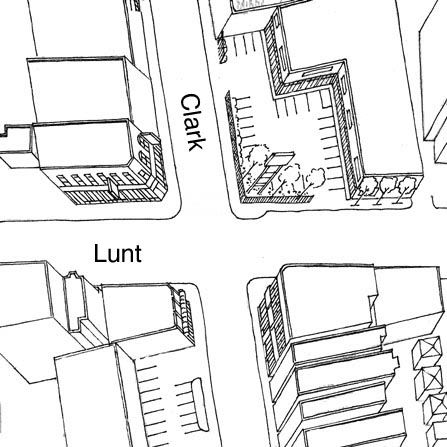
Clark and Lunt- Bird's Eye View

OK, not a true bird's-eye view, since it combines two paraline drawings. But a good way to add additional months to the project. To be honest, I can't imagine doing this for twenty-five more intersections.

So we spent a long weekend in North Carolina about 3 weeks ago. Angela was invited to teach an improv workshop, and Felix and I tagged along. It was like getting an amazing spring preview. We spent alot of time with our friends Dan and Lee, and explored the Raleigh, Durham, Chapel Hill area, which is beautiful. Dan and Angela used to perform together, and it was his theater that had extended the offer for a workshop. Apparently it was a big hit.

I'm amazed at how quickly Felix adapts on these trips. After the first day he said, "I like our new car." We tried to explain that it was a rental. Once we returned to Chicago he kept asking if we were going back to the hotel. As long as we're all together he's home.

Tuesday, March 24, 2009

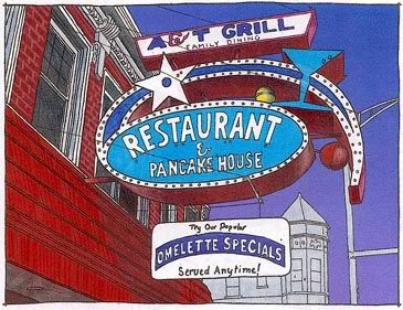
Clark and Greenleaf- A&T Grill Signage

OK, still putting together some color graphics for signage on Clark. For anyone who's interested, here's the most recent process:

-Develop outline from reference photograph. In this case I made two versions, one which eliminates the background elements to focus just on the sign.
-Scan both versions to print out at slightly larger size. Decide to use the more cluttered version.

-Develop grey marker tone study.
-Develop color drawing with Prismacolor markers.
-Scan into 300 dpi tiff. Adjust edges. Add graduated background tone.
-Print scan. Create highlights and details with Prismacolor pencils.
-Rescan. Adjust colors. Create reduced size version for blog.

Not sure it was worth the effort, but I want to give a copy to the owners of the A&T Grill. It might make them hesitate if they're considering removing the sign. It's already missing quite a bit of neon.

Saturday, March 14, 2009

Clark and Lunt- Currency Exchange

OK, another second tier financial service on Clark. We actually get our city stickers here. Also one of the few corners in Rogers Park where prostitutes are regularly arrested.

Tuesday, February 24, 2009

Money Transfers and Check Cashing on Clark

I had never seen these businesses before I moved to Chicago. Cash transfers are everywhere in Rogers Park. They're probably as common as the payday loan stores.

These businesses aren't regulated like banks, and they may charge rates that take advantage of workers who don't have many other options, like bank accounts or credit cards... 

Not sure anyone can fit more signage on this building.

Thursday, February 19, 2009

Clark and Schreiber, northwest corner

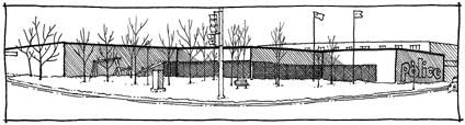
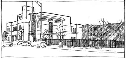
Do you remember the "literals" craze in the 1980s? Bags labeled "Brown Bag" and mugs labeled "Mug"? Did you know they did the same thing with buildings? The Rogers Park police station is living proof. In huge lowercase letters it reads, "police" on the wall nearest Clark. As if that could make up for the aggressively unattractive design. Maybe worse of all, it creates a huge windswept plaza along the most auto-dominated stretch of Clark. Optimistically there's a single bench. And what kind of trees were chosen for the plaza? Locust trees, whose most admirable quality is resistance to pollution.

Wednesday, February 18, 2009

Clark and Farwell, northeast corner

The Rogers Park Library is one of the few new buildings in the neighborhood that I really admire. Designed by Antunovich and Associates, it was built in 1999 and is aging comfortably. This is apparently the new model for Chicago libraries, and similar versions can be found in Bucktown and Edgebrook. Thankfully they stopped building those awful blue cinder block libraries. If you're in the neighborhood go up to the second floor and admire the hanging sculpture. Public buildings of this quality make me glad to live in Chicago.

Sunday, February 15, 2009

Clark and Pratt, southwest corner

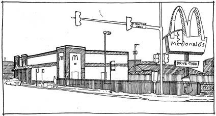
So McDonald's has started to replace their old 1980s mansard-style outlets with something a little more sensitive to the street Sure, they'll still surrounded by parking lots and driveways, but they're faced with brick, they're typically built with one wall right on the street, they have decent storefronts, and the interiors are better designed and more comfortable. Say what you will about McDonald's, but I'm impressed that they periodically reinvent themselves.

We took Felix to the Museum of Science and Industry on Saturday. If we hadn't felt a crazy need to see everything we would have just stared at the amazing model train exhibit for hours. They basically created the Loop, complete with working CTA trains. Wow.

On Sunday we took Felix to get his hair cut. At the end of the haircut the woman said, "Oops, I nicked his ear. Free haircut." Sure enough, there was a tiny cut on the top of his ear which Felix barely noticed. We were left conferring on what to do. Should we just leave? Should we give a tip anyway, since we already saved $20? Should you tip someone who just cut you son's ear? We grabbed a lollipop and shuffled out awkwardly.

Wednesday, January 28, 2009

Clark and Lunt, northeast corner- 1890s through 2008


Our corner is on the far right. At this point (1890s) it was a post office.


Who doesn't love an old timey bus? Here's the first Philip's Bank. c. 1915?


Here's the upgrade of Philip's Bank in the 1920s.


And here's the triumphant replacement. I believe it was built in 1997, two years after I moved to Chicago.

Monday, January 26, 2009

Clark and Devon, northeast corner- 1910 and 2009


Apartments and Retail, c.1910


Devon-Clark Hardware, 2009

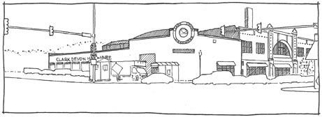
I'm fairly certain that this demolished apartment building explains the strangely shaped parking lot west of Devon-Clark Hardware. Still trying to figure out the map chronology, which is somewhat vague for this area.

Saturday, January 24, 2009

Clark and Touhy, northeast corner

7201 N. Clark
Built: 1955 (this is probably a rebuild)

This gas station was out of business when I started this project. But here it is, triumphant in its reopening.

The past few weeks we've lived through some of the coldest Chicago weather I've ever experienced. We're all getting over various stages of colds, but otherwise fine. Last weekend we went to Winterfest at Warren Park, where Felix bounced on an inflatable trampoline for an hour, had a spider painted on his hand, and took home a tiger balloon animal. We attended the grand opening of a new firehouse on Clark (Mayor Daley gave a speech, but at least there were donuts). And we've pioneered the sport of toddler sledding as a practical form of neighborhood transport.

Thursday, November 20, 2008

Columbia and Clark, northwest corner

6733-37 N. Clark
Built: 1927
Architect: C.B. Kohn
Contractor: H.C. Wolf & Son
Cost: $17,000


This is a nice little liquor store that won some sort of award for its new storefront and awning. Maybe it participated in the facade rebate program before it ran out of money...

Anyway, its cold out. Not yet Chicago cold, but darn cold. As usual, when it gets cold we head out to the Botanic Gardens for some reason. We ran around the gardens and walked through numerous greenhouses. Not bad for a Sunday.