Thursday, February 23, 2012

Building Paranoia in Rogers Park

A few years ago I found a great collection of essays in a book titled, Architecture of Fear (1997), which contained the article “Building Paranoia,” by Steven Flusty.  It was adapted from a paper published for the Los Angeles Forum for Architecture in 1994 and develops a vocabulary for describing the kinds of spaces he saw being created throughout the L.A. region.  I remember reading this chapter, shuddering, and being thankful that I don’t live in L.A. Here's a quick summary:


Stealthy Space
Space that is obscured and cannot be found.

Slippery Space
Space that cannot be reached, due to contorted, protracted, or missing paths of approach

Crusty Space

Space that cannot be accessed, due to obstructions such as walls, gates, checkpoints, etc.

Prickly Space
Space that cannot be comfortably occupied.

Jittery Space
Space that cannot be utilized unobserved.

South side of Estes West of Sheridan
But soon I started to spot the same things in my own neighborhood.  Perfectly nice corners were being transformed into miniature prisons.  Storefronts were installed that could withstand medieval sieges.  Homes and apartments destroyed their beauty in the name of security. 

Chicago’s grid tends to discourage the creation of Stealthy and Slippery Space.  These seem to be more common in suburban areas, or large redeveloped areas.  But I’ll bet anyone can think of a few Crusty, Prickly, and Jittery Spaces in their own neighborhood.  Following are a few examples that I found uncomfortably close to home.


North side of Estes, East of Sheridan
What you see here are steel and concrete modifications to eliminate a potential gathering or resting spot.  One set is welded iron, and the other is cast concrete.  In another era maybe they would have set broken glass on the surfaces. I wonder what was going on out here that had to be eliminated.  Noisy kids?  Vagrants?  Criminal activity?  Whatever it was did these devices put an end to it.  I would argue that these actually make the block less safe by removing "eyes-on-the-street".  As Jane Jacobs observed, well-used sidewalks and public places are an important deterrent to crime.
Glenwood and Morse
     
You should see how lush the grass gets behind this wall.  It’s like a shag carpet.  This is a good example of prickly space. But the jokes on them!  You can sit on this wall if you don’t mind straddling the iron spikes.  At least until your legs go numb… Across the street the security gates remind you to walk a little faster.


East side of Clark, between Estes and Touhy.


It never occurred to me that people might be hopping from roof to roof illicitly.  Judging from these deterrents it must be common. Did someone break into a storefront through a skylight?  Is that something that's likely to happen again and again?  Sometimes these things are a permanent solution to a rare event.   This wins the prize for the most diversity in materials:  chain link, razor wife, and a starburst of sharp steel spikes.


Morse and Glenwood


Rogers Park also has plenty of Jittery Space.  This is a video camera in a box at the northwest intersection of Glenwood and Morse.  It has a blue strobe light and the police insignia, in case you were in danger of overlooking it.  Glenwood and Morse has a reputation (not-unearned) of being a trouble-spot.  But cameras can’t see around corners.  

Close-up detail


High tech surveillance never makes me feel safer.  I know that somewhere in an accounting department someone is trying to figure out how many cameras equal one police officer.   
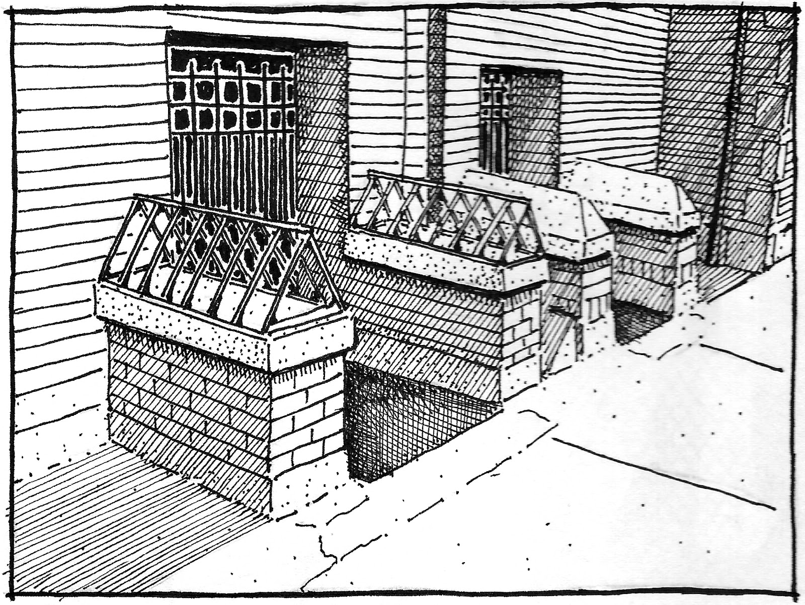


Clark and Greenleaf


This is one of the older commercial buildings in Rogers Park.   The owners have done everything possible to blind the building to anything happening at ground level.  Glass blocks fill the windows, and the security door is protected with a steel grate.  Just in case, an additional wrought iron gate guards the 3 concrete steps leading to the door.  And it works!  People rush by this building.  I doubt they even see the “No Trespassing” sign posted high on the wall.  This used to be one of Roger Park’s post offices.


The sad part is that there's often reason for these modifications.  How many times can you chase away drug dealers before you fence off your property?   How many times will you have your business or home broken into before the steel door and padlocks go up?  But there needs to be some type of balance at work.  I don't want Rogers Park to become one of those neighborhoods where you can't sit down without being expected to buy something.  Or have those streets where you never see a single human because of all the fences and walls.  We're all in this neighborhood together, even if we don't want to admit it.  And sometimes uncertainty is the price you pay for maintaining community.

Wednesday, February 15, 2012

Sheridan and Juneway, 1937

There are many collections on CARLI but it's hard to beat the IDOT Chicago Traffic Photographs, which document hundreds of streets and intersections from the 1920s through the 1950s.  And of course there are a few from Rogers Park.  Well, more than a few.  Because the photos relate to traffic I thought it might be interesting to focus on early auto facilities in the neighborhood and see where that might lead.
N. Sheridan Road and Juneway Terrace, 1937
This sign was amazing.  It looks about 4 stories tall.  At this point Sheridan Road makes a sharp right to skirt between Calvalry Cementary and Lake Michigan, so this sign effectively terminated the view north.  In a city of regular grids it's difficult to find elements like this, which are prominent from a long way off.  Bowman Dairy was huge in Chicago, but I had no idea they had their own radio program.  I couldn't find anything online about it, but I believe the Bowman archives are at the Chicago History Museum.

Adapted from the 1937 Sanborn Map
I'm guessing that the Colonial Revival house on the left was built between 1915 and 1920.  This portion of Juneway Terrace developed with single family homes in the 1920s, while the blocks to the west were dominated by large courtyard buildings.  The owners probably were not  pleased to find themselves next to the Rogers Park auto strip, which was fully developed by the time this image was recorded.  This house was demolished some time between 1962 and 1974 and replaced with a multi-family building.

Building #2 is the primary (or at least the largest) gas station/service station in the strip.  Their gas was supplied by Shell (see the sign?) and the building had interior bays for washing and repairs.  The circles represent underground gas tanks.  The national gas chains had been building stations in a variety of traditional styles since the 1920s. These were intended to standardize the experience of the driver and develop their corporate image in a neighborhood-friendly way.  But this design, with its peculiar Mediterranean charm,  seems to be unique.

 Building #3 was an auto-oriented snack shop for hungry drivers making their way to (or from) the North Shore."Demetre from Wilmette" made me think of Plaza del Lago, the formerly unincorporated portion of the lakefront near Wilmette which became a popular entertainment district and watering hole amidst the dry North Shore.  Sure enough, there was a "Villa Demetre" serving barbequed chicken sandwiches at Plaza del Lago (then known as No-Man's Land), although it was apparently destroyed by the 1932 fire which signaled the decline of that area.  Watch the video here! The Villa Demetre sign had the number "2" above it, while this building had the number "1" above its sign.  Did this tiny snack shop come first?  Possibly.  I'm also baffled by the tiny glass enclosure at the front of the building.  Was this so you could eat your lunch and watch the traffic whizz by without choking on the fumes?  Very odd.  Plaza del Lago made use of a Spanish Mission Revival style, and this building seems to make a nod in that direction as well.

Sheridan and Juneway as it looks today.
Building #4 is another service station, this one providing gas from Texaco.  It incorporates the Spanish tile roofs seen on the other structures, and some arched details as well.  Difficult to say if this is brick or stucco. 

There was another gas station just to the east, but it wasn't included in the image from 1937 so I left it out.  But it's interesting that these auto-related businesses began to cluster from the very start.  You could see this early on in Chicago's historic Motor Row and later at the used-car lots and motels strips to be found throughout the city.  They seemed to thrive on proximity and competition.

As a side note, there was still a gas station at this location when my wife moved to an apartment half a block away in 1997.  That night their moving van was broken into and she walked over to that gas station to make a police report from their pay telephone.  Ah, the memories.